

You can find on this page the Portugal region map to print and to download in PDF. The Portugal political map presents states, regions, provinces and surrounding areas of Portugal in Europe.
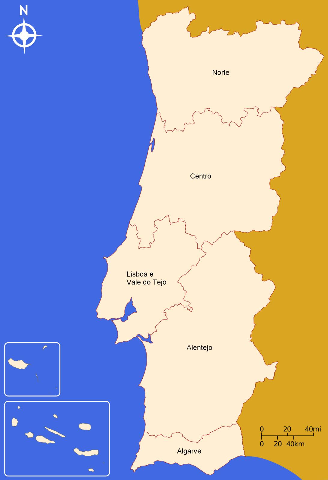
The Portugal regions map shows surrounding areas and provinces of Portugal. This administrative map of Portugal will allow you to know regions of Portugal in Europe. The Portugal regions map is downloadable in PDF, printable and free.
Portugal is divided into 7 different NUTS II (“Nomenclature of Territorial Units for Statistics), corresponding to its “regions”: North; Centre; Lisbon Metropolitan Area; Alentejo; Algarve; Autonomous Region of the Azores; Autonomous Region of Madeira – which have been divided into 25 NUTS III, becoming “administrative units”, corresponding to “sub-regions” (23 Inter-municipal communities in continental Portugal) as its mentioned in Portugal regions map. The regions of Alentejo, Centre and North hold the largest areas of territory and the Autonomous Region of Madeira is the smallest.
The two Autonomous Regions of Portugal (Portuguese: Regiões Autónomas de Portugal) are the Azores (Região Autónoma dos Açores) and Madeira (Região Autónoma da Madeira) as you can see in Portugal regions map. Together with Continental Portugal (Portugal Continental), they form the whole of the Portuguese Republic. Portugal has been divided into a number of regions since its formation as an independent kingdom in 1137.
Following the Reconquista in 1249 these historical regions of Portugal were from north to south as its mentioned in Portugal regions map: Entredouro & Minho, Trás-os-Montes, Beira, Estremadura, Alentejo and Algarve. In the 1930 when Portugal was controlled by the Salazar regime and the Estado Novo, a division of the country into 11 regions took place. These were: Minho, Douro Litoral, Trás-os-Montes e Alto Douro, Beira Alta, Beira Baixa, Beira Litoral, Estremadura, Ribatejo, Alto Alentejo, Baixo Alentejo and Algarve. These regions were based on the work of geographer Amorim Girão.

The Portugal political map shows regions and provinces of Portugal. This administrative map of Portugal will allow you to show regions, administrative borders and cities of Portugal in Europe. The Portugal political map is downloadable in PDF, printable and free.
Politics in Portugal take place in a framework of a parliamentary representative democratic republic, whereby the Prime Minister is the head of government, and of a multi-party system as its mentioned in Portugal regions map. The President of the Republic is the head of state and has several significant political powers, which he exercises often. Executive power is exercised by the Council of Ministers. Legislative power is vested in both the government and the Assembly of the Republic. Since 1975 the party system is dominated by the social democratic Socialist Party and the liberal conservative Social Democratic Party. The Judiciary is independent of the executive and the legislature.
The national and regional governments are dominated by two political parties, the PS, a Social Democratic party, that resembles the British Labour or the German SPD, and the PSD, a conservative party, member of the European People Party, that have similar base politics in some themes as its shown in Portugal regions map: both are Pro-Europe and support the market economy. Other parties with seats in the parliament are the Portuguese Communist Party, the People Party, the Leftwing Block and the Green Party. The Communists and the Greens are in coalition as the Unitarian Democratic Coalition.
The Portuguese political scene has been dominated by the Socialist Party and the Social Democratic Party since the Revolution, although the Popular Party had been present in some post-revolution governments and the Portuguese Communist Party in coalition with The Greens holds the presidency of several municipalities (see in Portugal regions map).

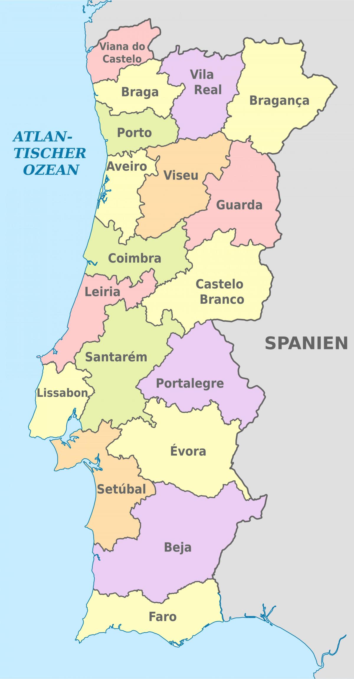
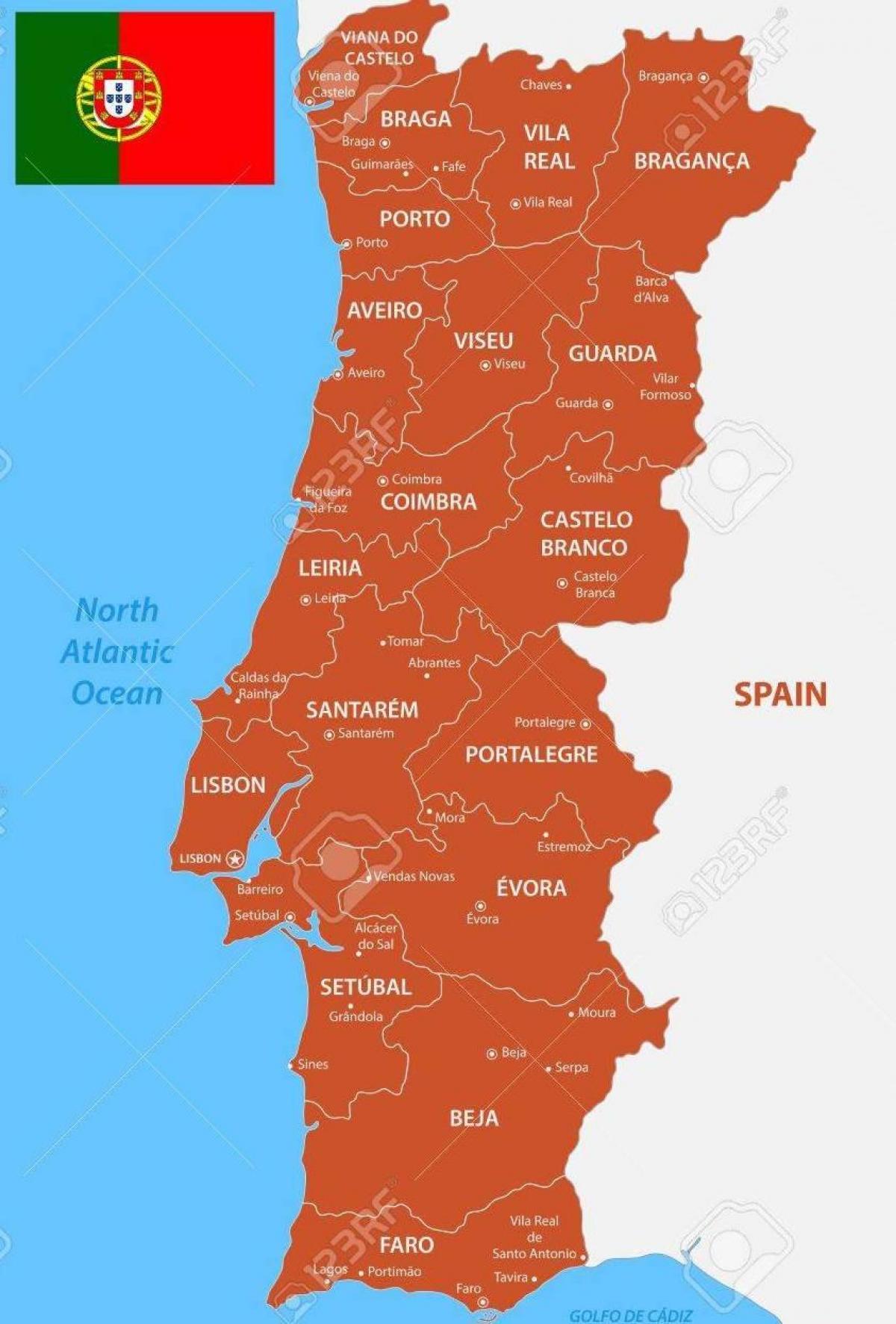
The Portugal states map shows all departments and regions of Portugal. States map of Portugal will allow you to know areas and cities of Portugal in Portugal. The Portugal states map is downloadable in PDF, printable and free.
Alongside NUTS, continental Portugal is divided into 18 Districts or states (Aveiro, Beja, Braga, Bragança, Castelo Branco, Coimbra, Evora, Faro, Guarda, Leiria, Lisboa, Portalegre, Porto, Santarém, Setúbal, Viana do Castelo, Vila Real and Viseu) as you can see in Portugal states map. The states of mainland Portugal are now almost meaningless supramunicipal entities, since the NUT2 regions are being used. Following the 1974 Revolution, Portugal regions were reclassified again in 1976, this time into 18 states and two autonomous regions: Madeira and The Azores. The establishment of 8 larger administrative regions to replace the 18 states was rejected in a 1998 referendum. The 18 states are based on municipalities .
Aveiro state is located in the central coastal region of Portugal. The Beja state is located in southern Portugal as its shown in Portugal states map. The state of Braga is a district in the northwest of Portugal. Bragança state is a traditional political division of Portugal, in the northeast corner bordering on Spain, covering 7.4% of the nations continental landmass. Castelo Branco state is located in Central Portugal, the state capital is Castelo Branco, which is now also the most populous city, although the city of Covilhã was once the largest city. Coimbra state is located in the Centro Region, the state capital is the city of Coimbra. Évora state is located in Alentejo, in southern Portugal. The state of Vila Real is a district of northern Portugal. With an area of 4,239 km², the state is located west of the port city of Porto and north of the Douro River. The state of Viseu is located in the Central Inland of Portugal.
The state of Guarda is located in the Centro Region of Portugal as its mentioned in Portugal states map, except Vila Nova de Foz Côa, which is in the Norte Region. The state of Leiria is located in Central Portugal. The state Capital is the city of Leiria which is also the largest city and most populous city. Lisbon state is a district located in the South Central Portugal. Portalegre state is located in the South of Portugal. The state of Porto, sometimes Oporto in English, is located on the north-west coast of Portugal. The District of Santarém is located in Centro Region, Portugal, the state capital is the city of Santarém. The state of Setúbal is located in the south-west of Portugal, the state Capital is the city of Setúbal. The state of Viana do Castelo is a state located in the northwest of Portugal, bordered by Spain from the north and Braga District from the south.